Chicago is a city of vibrant neighborhoods, rich history, and economic diversity. But a look beneath the surface reveals stark contrasts in wealth and poverty depending on where you live.
The poverty level (also called the poverty line or poverty threshold) is an income benchmark used by the federal government to determine whether individuals or families qualify as living in poverty. It’s primarily used to assess eligibility for government assistance programs and to track economic well-being across the country.
The U.S. Census Bureau sets the poverty thresholds, while the U.S. Department of Health and Human Services (HHS) releases poverty guidelines each year based on those thresholds. The guidelines are a simplified version used for administrative purposes, like determining eligibility for programs like Medicaid, SNAP (food stamps), and free school lunches.
The poverty level is based on household income and family size. It represents the minimum income needed to cover basic needs like food, housing, and clothing.
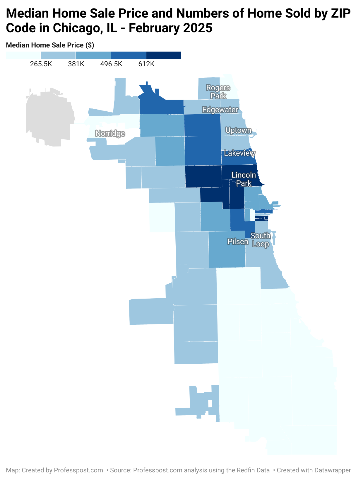
Several neighborhoods on Chicago’s South and West Sides report poverty rates well above 30%, far exceeding the citywide average. ZIP code 60624, which includes parts of West Garfield Park, has the highest poverty level at 35.9%. Close behind are 60621 (Englewood) at 33.6%, and 60637 (Greater Grand Crossing and Woodlawn) at 32.2%.
These areas have long struggled with disinvestment, high unemployment, and limited access to quality education and healthcare. The persistence of such high poverty rates points to systemic issues that have yet to be adequately addressed.